by Gregg Knutsen,
Agassiz NWR
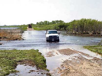
Given the recent flash flood in Middle River and flood conditions in other parts of northwestern Minnesota, the timing is right to provide an overview of water management on Agassiz National Wildlife Refuge.
Too much water isn’t good for anyone. Not homeowners. Not agricultural producers. Not even ducks or other waterbirds during the nesting season. One of our biggest management challenges at Agassiz Refuge is to maintain stable water levels during the nesting season (roughly early May through early August). The Thief River Watershed, which the Refuge is located in, is more than 1,070 square miles in size and presently contains 1,200 miles of public (county, state) drainage ditches. The majority of these ditches serve one purpose, to drain water from agricultural lands. The Refuge is situated roughly in the middle of this watershed and receives the majority of its water from the north and east via the Thief and Mud Rivers, as well as several public ditches. All of the water released from the Refuge flows into the Thief River south to the city of Thief River Falls. Conversely, the city of Middle River is in the Snake River Watershed, where water generally flows west and southwest towards the Red River.
Although agricultural production in this region is very important, the combination of extensive ditching and historic wetland loss does result in greatly altered hydrology within the Watershed. Runoff from a big rain event upstream of the Refuge typically hits it “like a ton of bricks.” An example would be a two-inch rain event to the north and east of the Refuge. If Agassiz Refuge staff do not actively manipulate water levels in many of our 20-plus impoundments (pools), water levels would bounce by more than half a foot, and flood out nests of several thousand waterbirds. Species like Franklin’s gulls, black terns, red-necked grebes, Wilson’s phalaropes, yellow rails, canvasbacks, and redheads are all prone to nest destruction during heavy rain events. If we do not reduce water levels in Refuge pools, it’s not just the wildlife that suffers; such a bounce can result in dike and water control structure failure.
Similar to an agricultural field, or a small town’s storm sewer, wetland impoundments can only handle so much water. Considering that the Refuge’s largest impoundment (Agassiz Pool) is currently holding more than 24,000 acre-feet of water, structural failure of an impoundment of this size would result in dramatic downstream flooding. During portions of the spring of 1997, our staff patrolled Refuge dikes 24 hours a day due to fears of infrastructure failure.
Fortunately, in recent years, we have acquired various technologies that greatly aid in managing water levels in pools. Two automated rain gauges exist on opposite ends of the Refuge and multiple water-level monitoring devices have been installed upstream of, within, and downstream of the Refuge. Staff can check water levels via the Internet and determine whether runoff in an upstream ditch has peaked or will increase. Similarly, we can determine what impact Refuge discharges are having on the Thief River downstream. Available data allow us to calculate the rate (cubic feet/second) of certain inflows and this helps us determine how much and where we need to release water from in order to protect overwater nesting birds.
Agassiz Refuge water management during the spring, summer, and fall is generally a highly coordinated effort, with regular communication occurring between the Refuge and the Minnesota Department of Natural Resources, the Red Lake Watershed District, and the City of Thief River Falls water management personnel.
During extended wet periods, such as this spring/summer, area landowners also contact us to express concerns about how water management on the Refuge might be impacting their crop fields. This is where being located in the middle of a watershed becomes especially challenging. After a large rain event or during a problematic spring runoff, it’s not uncommon for the Refuge to receive phone calls from both downstream and upstream landowners. One group asking that we scale back our releases because their crop fields are flooding, and the other asking that we increase our discharges because water is not adequately draining off of their crop fields. Understanding the needs of both groups of landowners, while at the same time protecting wildlife resources for the American public, can be challenging, to say the least. All the while, Mother Nature has the final say.
So, although common sense suggests that “ducks love and need water,” too much water at the wrong time of year can be a nesting duck’s worst nightmare. So, let’s all cross our fingers for an extended period of dry, sunny weather!

